449of 451 head
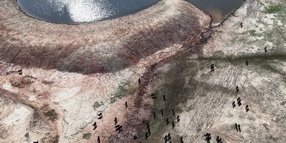
296 cows141 calves12 bulls
2 head out south of the River Bottom fence. Bring them in today.
We call it a round.
A local pilot flies your ranch, anywhere in Texas. You get what we found, where it is, and the pictures.
 Built with Heath Ownbey, cattle manager at the W.T. Waggoner Ranch
449of 451 head
296 cows141 calves12 bulls
2 head out south of the River Bottom fence. Bring them in today.
62%Windmill tank, down 8 points in a week
About 8 weeks of water at this rate. Look at the float valve this week.
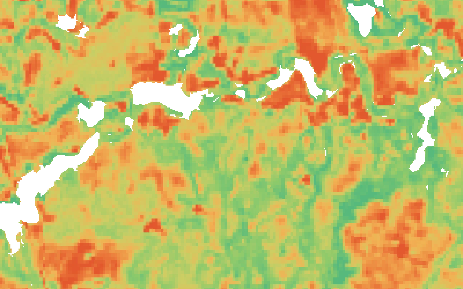
21 daysof grazing left on the Hill
Plan the move off the Hill by Nov 17.
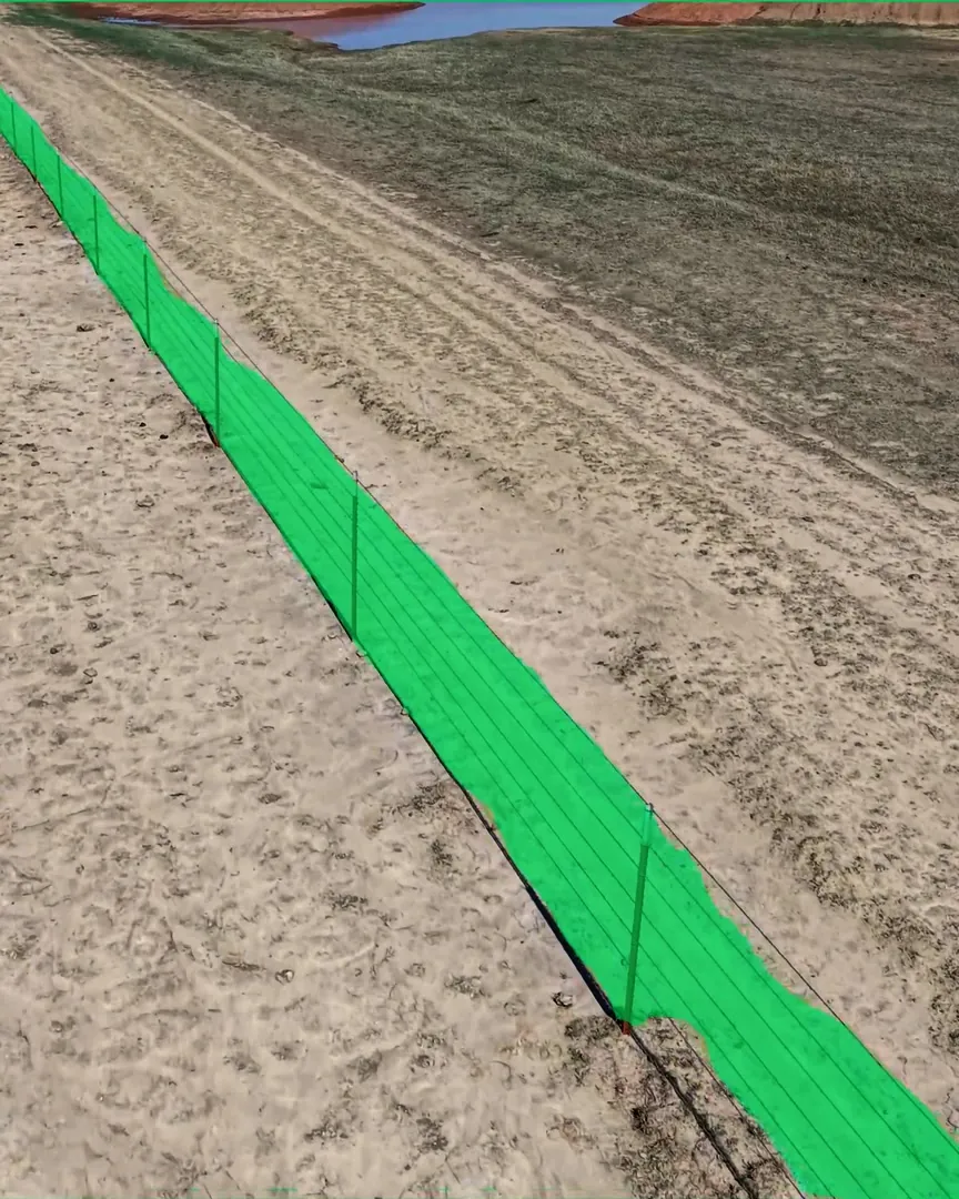
1 breakTop two wires down, about 30 ft
Hill fence33.95886° N
99.42309° W
Splice it this week, before the Hill cattle find it.
Example report

We’ll plan your round.
FAA-certified, on the schedule you set.
Each one with the pictures behind it.
See a sample report98%head-count accuracy in our own tests
Our engineers built AI models for environments that never hold still: cattle on the move, changing light, ground that shifts with the season.


Herd · detection and tracking
A detection model finds each animal in every frame the drone films. A tracking model gives each one its own ID and follows it from frame to frame, so a herd that moves under the drone is still counted once.
Fences and water · inspection
A fence model follows the wire through the footage looking for breaks and down wire, and pins each finding to the stretch of fence it is on. A water model reads the level of each tank the drone passes, so a tank that is dropping shows up before it runs dry. Before the report reaches you, one of us checks what the models found against the footage.
Grass · forage and pasture health
A pasture model reads the round’s pictures for grass cover and bare ground and estimates the standing forage, in pounds per acre. Set against your head count, that becomes grazing days left, so you know which pasture to move off first. Between rounds, satellite imagery keeps a health map of every pasture up to date.
Cattle model
It finds each animal in every frame the drone films and gives each one its own ID, so a herd that moves under the drone is still counted once.
Fence model
It follows the wire through the footage for breaks and down wire, and pins each one to the stretch of fence it is on, with the picture.
Water model
It reads the level of each tank the drone passes, so a tank that is dropping shows up before it runs dry.
Pasture model
It estimates the standing forage in pounds per acre. Set against your head count, that becomes grazing days left, so you know which pasture to move off first.
Then one of us
Before the report reaches you, one of us checks what the models found against the footage.
Our models read new satellite pictures of your ranch for grass and water, so the next round goes where it’s needed. Here’s how that works on one ranch.
Pasture model, 2,321 acres of range. Grass grown in 2025: 2,180 pounds an acre, 2% below the average since 1986. It can carry about 130 cows all year at moderate stocking. Zone A, Drying fastest, 42% of the ground: 2,200 pounds an acre, 220 days for 100 cows, −5% against its own average. Zone B, Holding up, 34% of the ground: 2,400 pounds an acre, 195 days for 100 cows, −2% against its own average. Zone C, Thin all year, 17% of the ground: 1,720 pounds an acre, 70 days for 100 cows, +14% against its own average. Zone D, Creek and field, 6% of the ground: not estimated. Pounds an acre from the Rangeland Analysis Platform; days at moderate stocking after Texas A&M AgriLife.

The tank our satellite flagged. Filmed by our pilot’s drone on October 22, 2026.
Water in the tank. We’ll get the results back to you.
See a sample report 
Built with Heath Ownbey
“We could drive around for days on the ranch that I work on here, and can’t see all of it.”
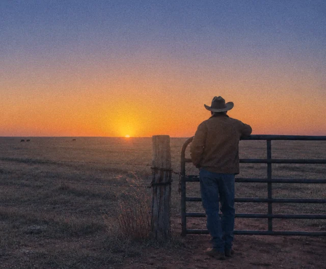
Today, checking means a cowboy on horseback or a hand on an ATV riding every fence line and tank to find the one thing that’s wrong. That is wages, fuel and most of a day, every time. A round covers that ground from the air and hands your crew a short list. Their hours go to fixing, not looking, and trouble is caught sooner: a ranch that runs leaner and loses less.
The hours your hands spend in the saddle or on the ATV go to the jobs on the list, not to finding them.
Less fuel and less wear on trucks and ATVs, and fewer paid hours spent looking. Our founding ranches get rounds at a heavily discounted price.
A problem found sooner costs less: a tank before it’s dry, a wire before the cattle find it, a stray before she’s gone.
Rounds are priced by the acre, depending on your operation. We set it with you on a call. We’re choosing our founding ranches now: they get rounds at a heavily discounted price, and we shape the service around how their ranch really runs.
Yes, anywhere in Texas. Tell us your county and we’ll match you with a pilot nearby.
A local pilot certified by the FAA (Part 107), with the drone in sight the whole flight. We bring on every pilot ourselves.
It shouldn’t. Pilots fly steady, planned passes and keep their distance. Some cattle look up the first few times; published work on drones around livestock reports fewer of them reacting with each flight.
No. The drone records on board, and we read the footage after the flight.
Yes. Every round is flown under FAA Part 107 by a certified pilot, with the drone in sight, only with the permission of whoever owns or runs the land. The pilot checks the airspace before every flight.
Got another one?We’d love tohear it.

We’ll check your cattle, fences, water and grass.

Fly rounds for ranches near you.


